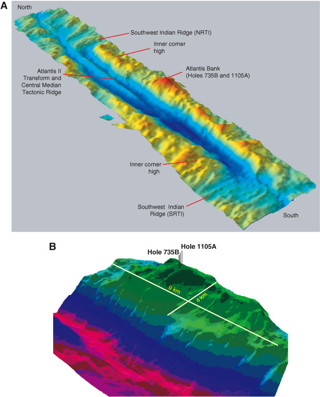
Figure F2. A. Three-dimensional shaded bathymetry of the Atlantis II Transform Fault, showing the northern and southern ridge transform intersection (NRTI and SRTI, respectively), and the median tectonic ridge in the transform. Locations of Hole 1105A and 735B atop the Atlantis Bank represent the highest point along the eastern transverse ridge of the Atlantis II Transform (bathymetric grid provided by H. Dick, pers. comm., 1999). B. Three-dimensional shaded-relief image of the Atlantis Bank (looking northeast) along the wall of the Atlantis II Transform Fault (data from Dick et al., 1991). Holes 1105A and 735B and the dimensions of the Atlantis Bank are also shown (modified from Shipboard Scientific Party, 1999c).