![]()
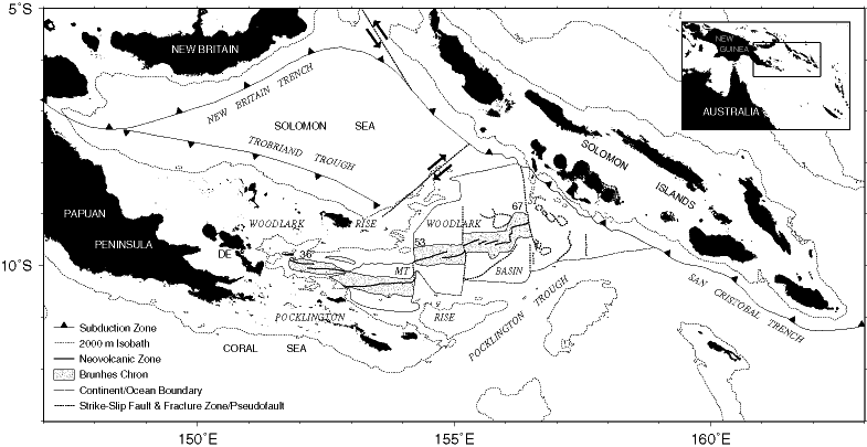
Figure F1. Major physiographic features and active plate boundaries of the Woodlark Basin region. The stippled area encloses oceanic crust formed during the Brunhes Chron at spreading rates labeled in millimeters per year. MT and ST = Moresby and Simbo transform faults, respectively; DE = D'Entrecasteaux Islands. Inset, geographical location of the Woodlark Basin.
![]()