![]()
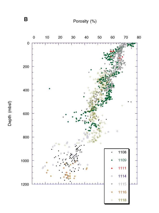
Figure F11 (continued). B. Porosity data, with depth shifts as follows: Site 1108: 500 m added to mbsf depths above 165 mbsf (the location of a fault zone), 700 m added below 165 mbsf; 750 m added to Site 1114 data; and 1000 m added to Site 1116 data. Data below the unconformities at Sites 1109, 1115, and 1118 are not shown because of the unknown hiatus. See "Erosion Estimates" in "Thematic Overview," for discussion.
![]()