![]()
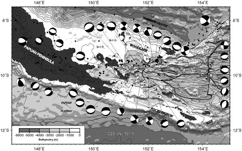
Figure F2. Topography of the Papuan Peninsula and bathymetry of the western Woodlark Basin showing relocated epicenters (solid circles) and earthquake focal mechanisms from Abers et al. (1997). E = Egum Atoll, GB = Goodenough Basin, G = Goodenough Island, F = Fergusson Island, N = Normanby Island, R = Rossel Island, T = Tagula Island, MS = Moresby Seamount, MT = Moresby transform fault, M = Misima Island, W = Woodlark Island. Exploration wells Goodenough-1 and Nubiam-1 are labeled G-1 and N-1. The solid line is the landward boundary of oceanic crust and the thin double lines locate the spreading axes (Taylor et al., 1995).
![]()