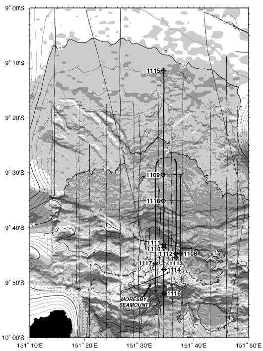
Figure F7. Locations of the Leg 180 drill sites and multichannel seismic tracks, plotted on a shaded relief map with 200-m bathymetric contours (thicker contours labeled every kilometer).