![]()
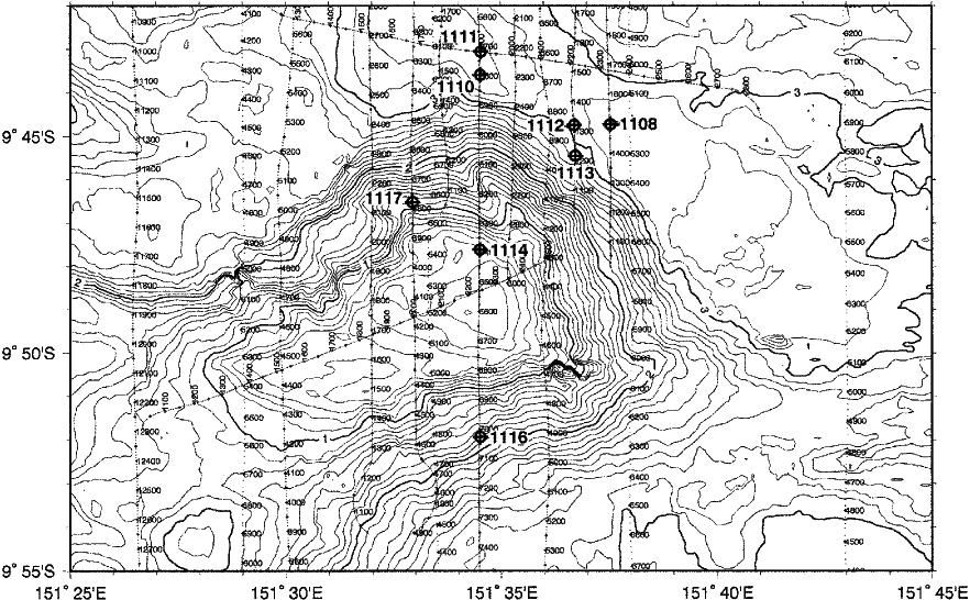
Figure F8. Multibeam bathymetric map (with 100-m contours and thicker contours labeled every kilometer) showing the locations of the Leg 180 drill sites in the vicinity of Moresby Seamount. Multichannel seismic tracks are plotted and labeled every 100 CDPs.
![]()