![]()
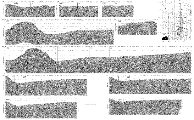
Figure F8. (An oversized figure accompanies this volume. Click image or highlighted text for PDF version.) Site survey multichannel seismic (MCS) data showing the position of sites drilled. The data are presented as migrated time sections. Lines 1369 and 1374 are also presented as migrated depth sections. The inset shows the location of the MCS lines on a bathymetry base contoured every 200 m and labeled in km. Bold numbers label the sites and bold italic numbers label the MCS lines. Common depth points (CDP) are annotated every 1000 on the inset and every 100 above the MCS data.
![]()