![]()
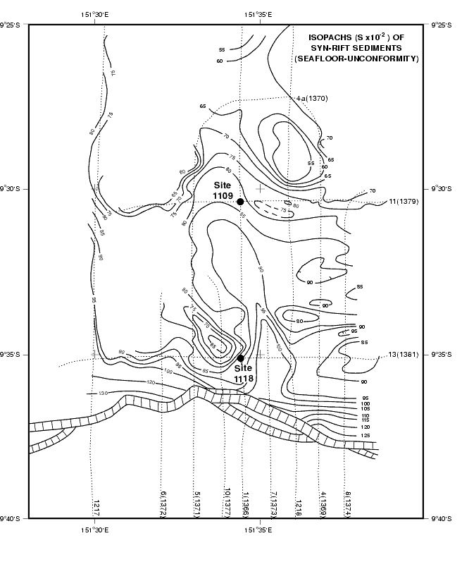
Figure F9. Isopach map of synrift sediments (i.e., between the seafloor and the angular unconformity above the forearc basin section) in the vicinity of Sites 1109 and 1118. Contours are labeled in hundredths of seconds of two-way traveltime. Dashed lines locate the MCS data used to construct the map. Hatched parallel lines mark the fault system that bounds the northern edge of the Woodlark rift basin.
![]()