![]()
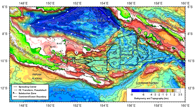
Figure F1. Major physiographic features and active plate boundaries of the Woodlark Basin region. E = Egum Atoll, G = Goodenough Island, GB = Goodenough Basin, F = Fergusson Island, L = Lusancay Islands, M = Misima Island, MB = Milne Bay, MH = Mullins Harbour, MS = Moresby Seamount, MT = Moresby transform fault, N = Normanby Island, R = Rossel Island, ST = Simbo transform fault, T = Tagula Island, TR = Trobriand Islands, W = Woodlark Island. Exploration wells Goodenough-1 and Nubiam-1 are labeled G-1 and N-1.
![]()