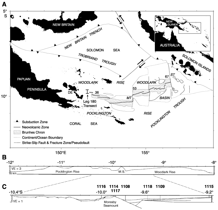
Figure F1. A. Major physiographic features and active plate boundaries of the Woodlark Basin region. The stippled area encloses oceanic crust formed during the Brunhes Chron at spreading rates labeled in millimeters per year. MT = Moresby transform fault, ST = Simbo transform fault, DE = D'Entrecasteaux Islands. Inset = the geographic location of the Woodlark Basin. B. Nested meridional sections at 151°34.5´E showing the regional bathymetry. C. Local structures across the incipient conjugate margins. Leg 180 drill sites are depicted on the B sections. VE = vertical exaggeration. From Shipboard Scientific Party, 1999.
![]()