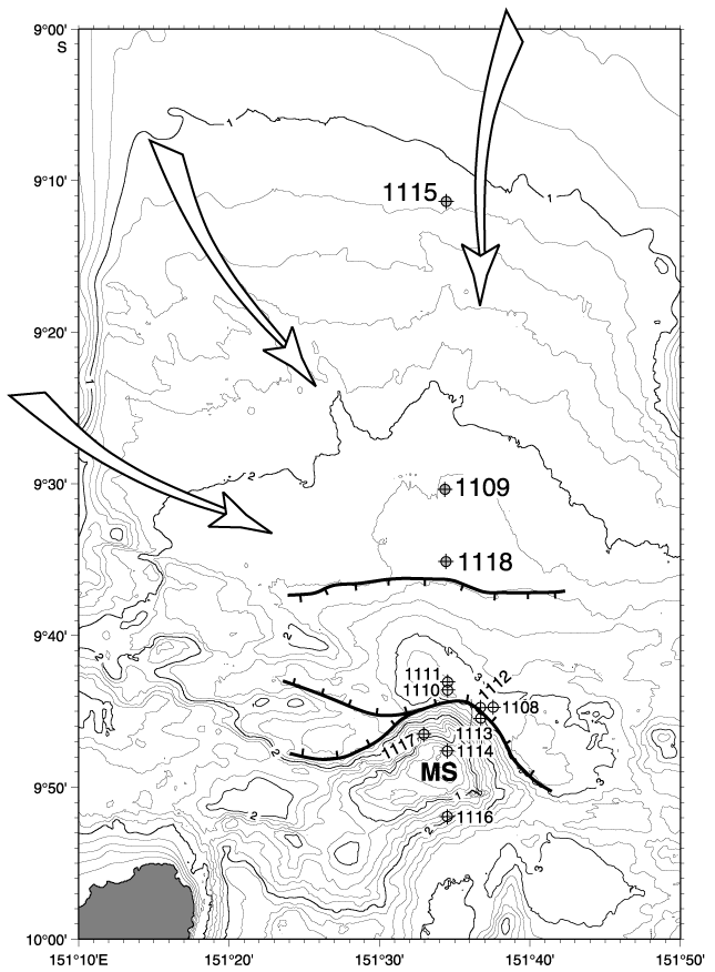
Figure F2. Location of ODP sites around and north of the Moresby Seamount (MS). Sites 1118, 1109, and 1115 are the focus of this paper. The bathymetric contour interval is 200 m; contours are labeled each kilometer of water depth. Bold lines with tick marks indicate the main normal faults and their direction of dip (from Taylor et al., 1999). Large arrows indicate sediment transport routes during the Pliocene (Robertson et al., in press).
![]()