![]()
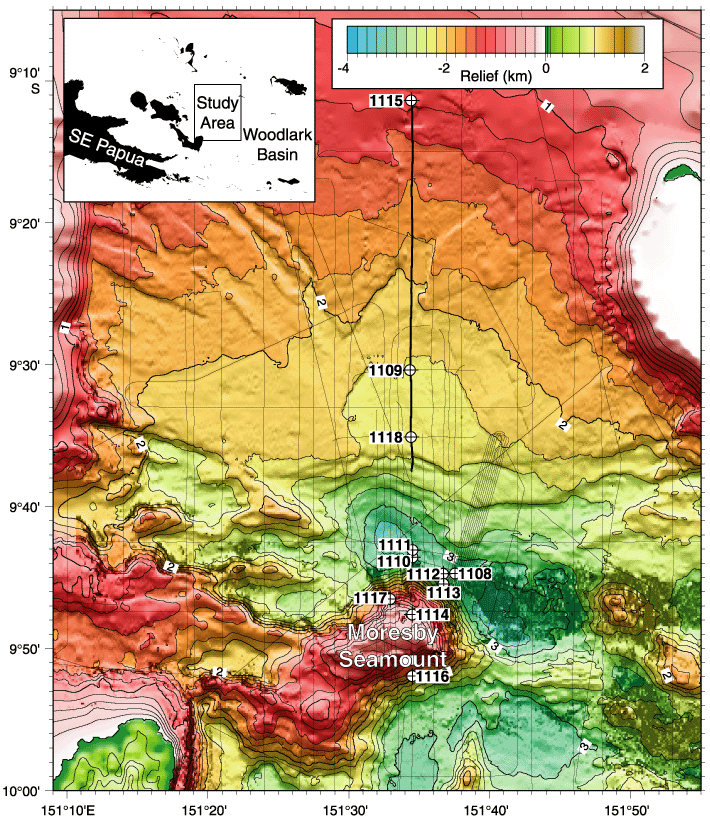
Figure F1. Regional setting of the Leg 180 drill sites. Sites 1118, 1109, and 1115 are on MCS line EW9510-1366, a segment of which (bold black line) is presented in Figure F2. Thin black lines indicate the location of regional seismic reflection data. HAWAII-MR1 side-scan data is overlain on bathymetry illuminated from the north (Goodliffe et al., 1999). The two westernmost spreading segments are evident from the high backscatter region trending east-west near 9°50´S on the eastern side of the plot. The bathymetry contour interval is 200 m, labeled in kilometers.
![]()