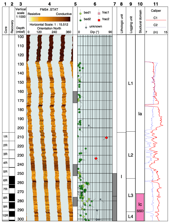
Figure F3. Composite log of Hole 1118A. From left: (1) core number, (2) core recovery, (3) depth, (4) static FMS image, (5) location of detailed FMS figures, (6) structural interpretation tadpoles, (7) depth intervals of detailed orientation plots, (8) lithologic units (summarized in Table T2), (9) logging units, (10) structural domains, and (11) caliper measurements. The thin vertical green line on the FMS images indicates the orientation of pad 1 that corresponds to the C1 caliper reading. The tadpole position on the horizontal axis indicates the dip magnitude, and its tail points toward the dip direction. In the structure column (10), deformed zones are highlighted in pink. SSD = soft-sediment deformation, SL = slump, FZ = fracture zone, BRC = breccia. The global image is cut in consecutive page-sized pieces. (Continued on next three pages.)