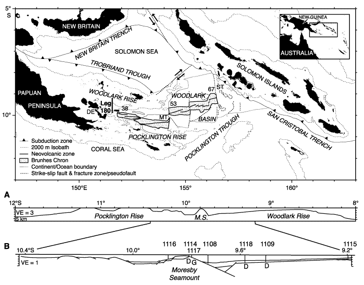
Figure F1.
Major physiographic features and active plate boundaries of the Woodlark Basin
region. The stippled area encloses oceanic crust formed during the Brunhes Chron
at spreading rates labeled in millimeters per year. MT and ST = Moresby and
Simbo transform faults, respectively, DE = D'Entrecasteaux Islands. Vertical bar
locates Leg 180 drilling transect. Inset is the geographical location of the
Woodlark Basin. Lower panels show nested meridional cross sections at 151°34.5´E:
(A) regional bathymetry and (B) local
structures across the incipient conjugate margins. Leg 180 drill sites are
projected on the B section. Drilled basement types are labeled: D = dolerite, G
= gabbro. VE = vertical exaggeration. M.S. = Moresby Seamount.