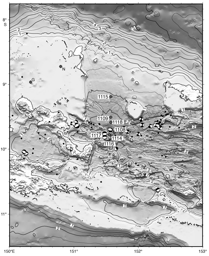
Figure F2.
Topography and bathymetry (contours labeled in kilometers) in the region of the
Leg 180 drilling transect, showing epicenters and focal mechanisms from Abers et
al. (1997) relocated 15 km south in accord with microseismicity data (see
"Shallow-Angle Moresby Normal Fault"). The thin double lines locate
the spreading axes (Taylor et al., 1995). G = Goodenough 1 well, N = Numbiam 1
well.