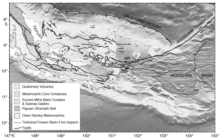
Figure F3.
Simplified regional geology, including offshore faults and depocenters. Small
circles locate active volcanoes, including Mt. Lamington (L), Mt. Victory (V),
and Dawson Strait (D). The dashed line locates the landward boundary of oceanic
crust, and the thin double lines locate the spreading axes. Ticks on normal
faults indicate the downthrown side; triangles on reverse faults, the upthrusted
side. Islands include Amphlett (A), D'Entrecasteaux (DE), Egum Atoll (E),
Lusancay (LC), Misima (MI), Trobriand (T), and Woodlark (W). M =
Moresby Strait, MR = Moresby rift, MS = Moresby Seamount.