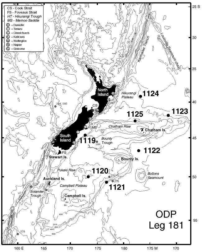
Figure F1. Bathymetric map of the eastern New Zealand region, Southwest Pacific Ocean, showing the location of previous DSDP sites and the location of all sites drilled during Leg 181. Depths in meters.