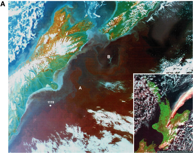
Frontispiece A. Coastal infrared satellite image of eastern New Zealand. Site 1119 is located near the junction between warmer subtropical water (blue) and colder subantarctic (magenta) water masses, which are separated across the Southland Front and are both northward traveling. Also marked are (A) the passage of both water bodies through the Mernoo Gap, east of Banks Peninsula, and (B) a small eddy spawned from the Wairarapa Eddy at the southern end of the south-traveling East Coast Current.1 Inset: satellite view from 650 km of the eruption of 17 June 1996 from Mt. Ruapehu, central North Island. Note the characteristic east-turning dispersion of the ash plume.2
![]()