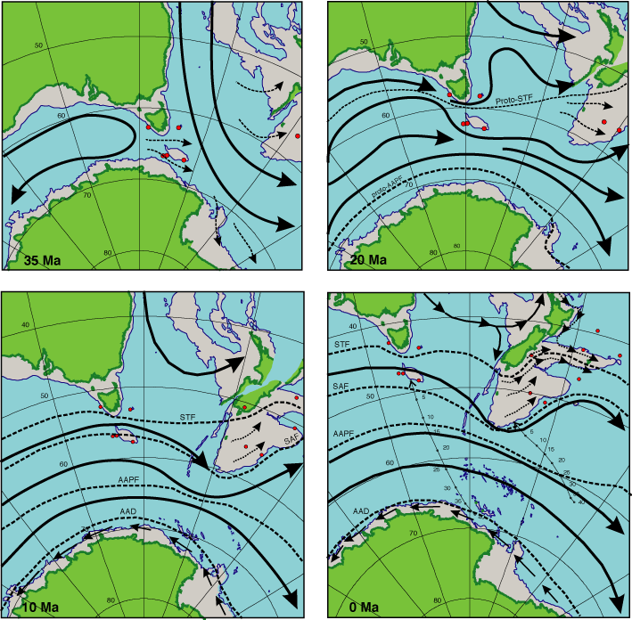
Figure F24. Reconstructed frontal systems and ocean surface circulation for the Australasian Southern Ocean at 35, 20, 10, and 0 Ma. Base map tectonic reconstruction by Sutherland (after Cande et al., 1995; Sutherland, 1995; Royer and Rollet, 1997). The maps are in transverse Mercator projection and show the present-day coastline, the 2000-m isobath, and the positions of sites drilled during Legs 181 and 187. Also plotted on the 0-Ma reconstruction are the apparent paleomagnetic polar wander paths for the Australian (Veevers and Li, 1991) and Pacific (Sutherland, 1995) plates, interpolated at 5-m.y. intervals to show the relative northwestward motions. STF = Subtropical Front, AAPF = Antarctic Polar Front, AAD = Antarctic Divergence, SAF = Subantarctic Front.