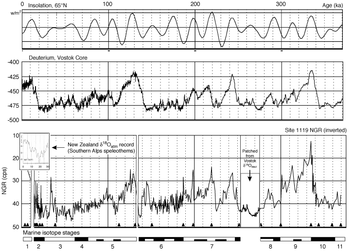
Figure F7. Climatic records from Site 1119 (water depth = 396 m), Canterbury upper slope (natural gamma ray [NGR] signal), and the Vostok ice core (deuterium isotope ratio), compared with the insolation curve for latitude 65°N (after Petit et al., 1999; Shackleton, 2000; Carter, R., et al., in press). Position of timescale control points (mapped from the Vostok core) indicated by black triangles along the base of the gamma ray record. Note the close correspondence of major climatic events as recorded in the widely separated temperate marine and polar ice cap records. Inset (top left of gamma ray record): proxy climate record for the last 30 k.y. for South Island, New Zealand, as indicated by oxygen isotope measurements on speleothems from Mt. Arthur, Southern Alps (Hellstrom et al., 1998).