![]()
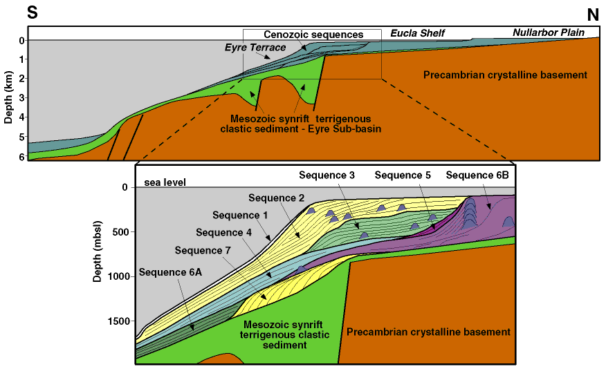
Figure F2. Schematic north-south diagram from the Nullarbor Plain to the upper continental slope across the Eyre Terrace (along longitude 128° E), showing the distribution and internal relationships of seven Cenozoic sequences (shown in blue in the top diagram) defined from seismic data, overlying Mesozoic synrift siliciclastic sequences (green), and Precambrian crystalline basement (brown) (after Feary and James, 1998, reprinted as Chap. 2). Vertical scales are approximate.
![]()