![]()
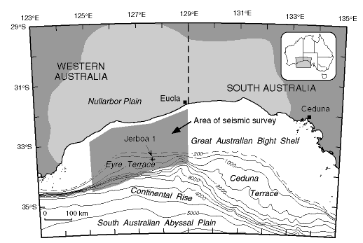
Figure 1Bathymetric map of the Great Australian Bight (inset map shows location), with the offshore shaded zone showing the area of high-quality seismic data on which this analysis is based. Light shading onshore shows the extent of the Cenozoic Eucla basin, broadly corresponding to the modern Nullarbor Plain. The location of oil exploration drill hole Jerboa 1 is also shown. Bathymetric contours are in meters. Modified from Feary and James (1995).
![]()