![]()
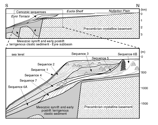
Figure 5Schematic north-south diagram from the Nullarbor Plain to the upper continental slope, across the Eyre Terrace (along longitude 128°E), showing the distribution and internal relationships of seven Cenozoic sequences defined from seismic data, overlying Mesozoic synrift and early postrift siliciclastic sequences and Precambrian crystalline basement. Note the distribution of reefs (dark shading) and biogenic mounds (light shading) within many of the Cenozoic sequences. Vertical scales are approximate. Modified from Feary and James (1995).
![]()