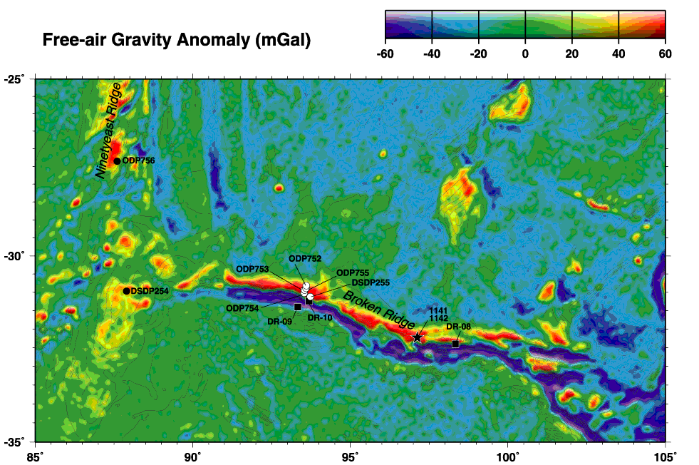
Figure F1.
Satellite-derived
free-air gravity map of Broken Ridge (after Sandwell and Smith, 1997). Current
(Leg 183) and previous (Legs 26 and 121) DSDP and ODP sites are indicated by
stars and circles, respectively (solid = basement sites). Solid squares indicate
dredge sites where igneous rocks were recovered.