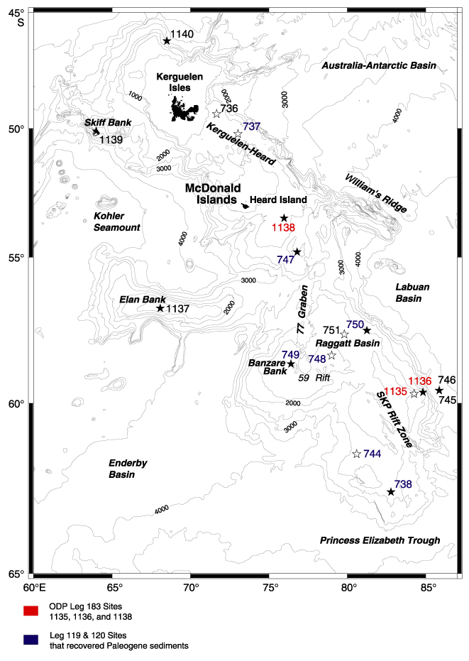
Figure F1. Bathymetry of the Kerguelen Plateau. Leg 119, 120, and 183 drill sites that recovered igneous basement are indicated by solid stars; sites that bottomed in sediment are shown as open stars. Contour interval = 500 m (after Shipboard Scientific Party, 2000a, fig. F3).


![]()