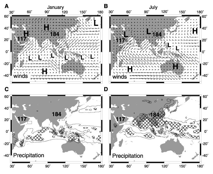
Figure F1. Climatology of the July and January monsoon circulation. A, B. Locations of ODP Legs 184 (northern and southern South China Sea) and 117 (Arabian Sea) are shown as open rectangles. Sea-level pressure and surface winds are shown by arrows; longer arrows indicate stronger winds. The strongest winds (B; northern Arabian Sea) are ~15 m/s. C, D. Precipitation is indicated by contours (6 mm/day) and hatching (>9 mm/day). The pressure gradients and resulting winds and precipitation patterns reflect land-sea heating contrasts, which are functions of solar radiation, elevation, and land-surface boundary conditions. Monthly data for 1990-1997 from the National Oceanic and Atmospheric Administration, National Centers for Environmental Prediction/National Center for Atmospheric Research, Climate Data Assimilation System-1 (NOAA NCEP-NCAR CDAS-1) (Kalnay et al., 1996).
![]()