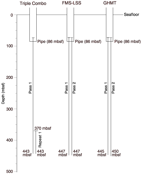
Figure F33. Graphic summary of downhole logging operations for Hole 1144A. The seafloor was identified based on a step in natural gamma activity at the sediment/water boundary. FMS = Formation MicroScanner, LSS = long-spaced sonic, GHMT = geological high-resolution magnetic tool.
![]()