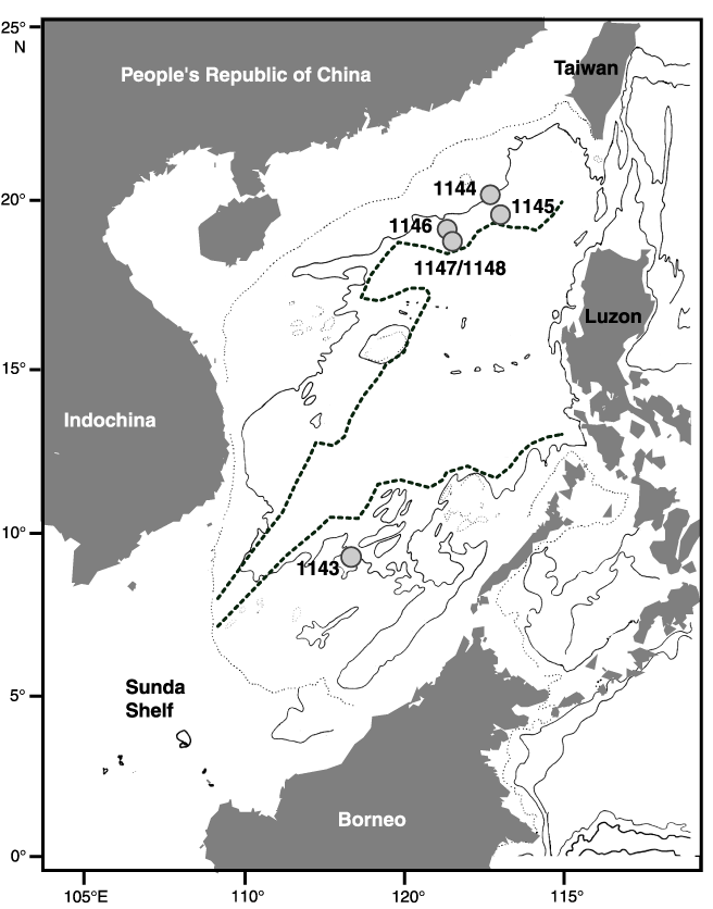
Figure F1.
Map of the South China Sea and location of the six sites drilled during ODP Leg 184. The thick dotted line indicates the continental/oceanic crust boundary, whereas the thin dotted line indicates the shelf limit.