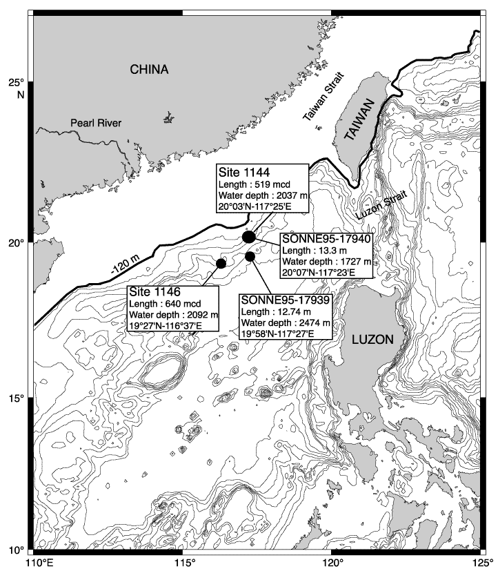
Figure F1. Topographic map of the South China Sea (SCS) and adjacent landmass showing locations of ODP Sites 1144 and 1146 and presite cores 17939 and 17940 from the Sonne-95 cruise (Sarnthein et al., 1994). Present 120-m isobath shows the approximate position of the coastline during low sea level.