![]() Figures F1-F17
Figures F1-F17
![]() Table
T1
Table
T1
F1. Location of Leg 186 sites.
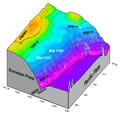
F2. Map of the Japan Trench area off northeast Japan.
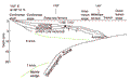
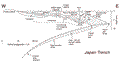
F3. Schematic cross section of the Japan Trench-arc system.
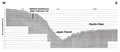
F4. Seismic record section across the Japan Trench.
F5. A model of tectonic subsidence history.
F6. Epicenters of large thrust earthquakes.

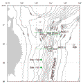
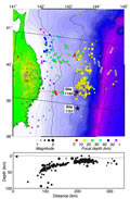
F7. Map of Japan Trench area with seismicity.
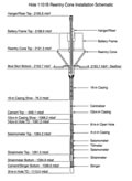
F8. Schematic of the seafloor and borehole installation for Hole 1150D.

F9. Schematic of the seafloor and borehole installation for Hole 1151B.
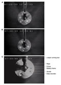
F10. The successfully deployed battery pack.
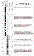
F11. Lithostratigraphic summary.
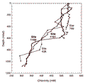
F12. Chlorinity change in interstitial water.
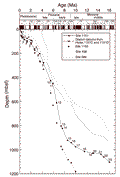
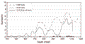
F13. Age-depth curves for Leg 186 sites and other Japan Trench sites.
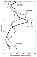
F14. Smoothed curve presentation of sedimentation rates along the Japan Trench.
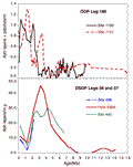
F15. Ash records from Leg 186 compared with other Japan Trench sites.
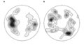
F16. Fault orientations.
F17. Frequency of faults.
T1. Leg 186 operational summary.