![]()
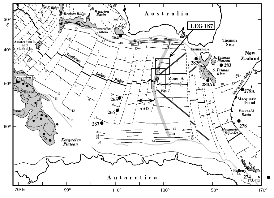
Figure F1. Regional map of the Southeast Indian Ocean (from Pyle et al., 1995) showing magnetic lineations (Cande et al., 1989), the Australian Antarctic Discordance (AAD), and Deep Sea Drilling Program (DSDP) sites (numbered solid circles) that sampled basement. Thin dark V east of the AAD = inferred trace of a hypothetical isotopic boundary migrating at ~40 mm/yr. Broader gray V = approximate trace of the regional depth anomaly. Bull's-eye symbols south of Australia = approximate positions of dredges by Lanyon et al. (1995). Darkly outlined box = area of operations for Leg 187; lighter outlined box = area of Figure F3, small solid circles = DSDP and ODP site locations.
![]()