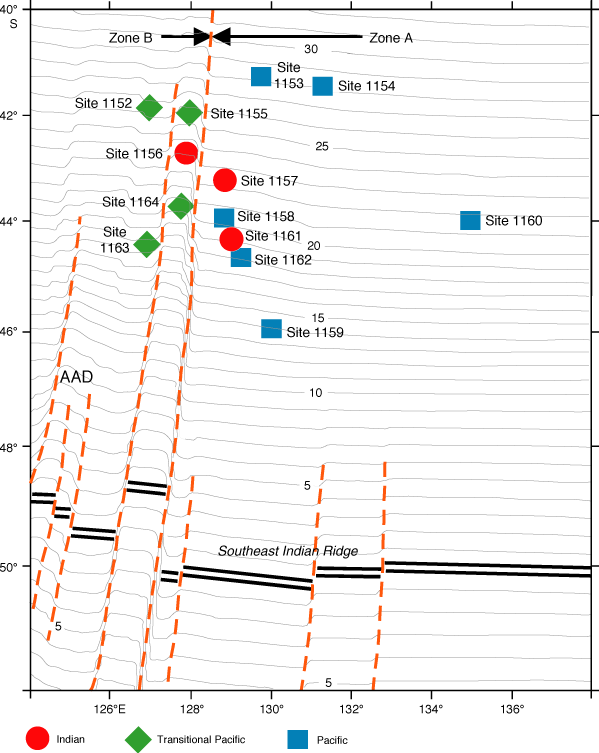
Figure F1. Locations of Leg 187 drill sites. Mantle provinces for each site are indicated. The Southeast Indian Ridge is shown as double heavy black lines, major fracture zones as brown dashed lines, and seafloor isochrons (Vogt et al., 1984) as thin gray lines. The Zone A and Zone B (the Australian Antarctic Discordance; AAD) tectonic segments extend to 140° and 120°E, respectively. The core samples were recovered from 23 holes at the 13 drill sites (Sites 1152-1164) with an average water depth of ~5000 m. The coring depth ranges from 20-60 m into the igneous basement (after figure F27, Shipboard Scientific Party, 2001).