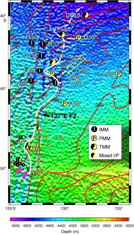
Figure F2. Satellite gravity map using data of Smith and Sandwell (1977). Contours outline residual depth anomaly (values in meters) of Marks et al. (1990). Larger circles are locations of Leg 187 sites coded as Indian Ocean MORB mantle (IMM), Pacific Ocean MORB mantle (PMM), or transitional MORB mantle (TMM) based on their isotopic compositions. "Mixed I/P" symbol indicates sites that recovered both PMM and IMM samples. Smaller circles are MW88 and BO05 dredge sites. Circles are coded for mantle domain type as determined by Pb isotopic data of D. Pyle et al. (pers. comm., 2004). Long arrows point to oblique lineations associated with rift propagation. Small arrows near 50°S indicate off-axis dredge sites referred to in text (see "Background: Mantle Flow Hypotheses" in "The Indian/Pacific Mantle Isotopic Boundary." Heavy white line is the trace of the Indian/Pacific MORB mantle boundary inferred from the isotopic compositions of Leg 187 and near-axis dredged samples. FZ = fracture zone.