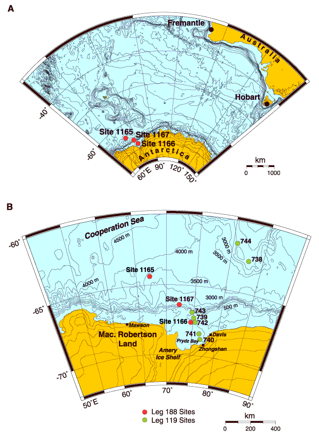
Figure F10. A. Overview map of the primary Leg 188 drill sites with respect to port of origin (Fremantle) and destination port (Hobart). B. Map of East Antarctic coastline between 50°E and 90°E, showing the location of Prydz Bay, Mac. Robertson Land, Antarctic stations, Leg 119 drill sites (light circles), and Leg 188 drill sites (dark circles).
![]()