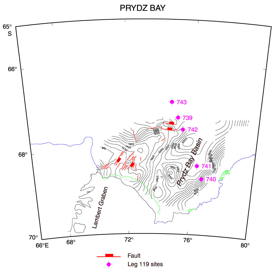
Figure F6. Structure contour map of the top of basement in Prydz Bay. Contours are in milliseconds two-way traveltime below sea level. A northeast-trending, faulted ridge separates the Prydz Bay Basin from the outer shelf.