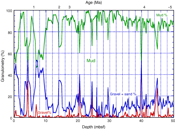
Figure F6. Granulometry of the HiRISC interval. Area below the gravel line is gravel, area below the gravel + sand line is gravel and sand, and remaining area is gravel, sand, and mud. The mud% line is for emphasis only. Note the increase in the sand component above 15 mbsf and particularly above 10 mbsf, signifying the occurrence of foraminifers in the sand-sized fraction. (See the "Supplementary Materials" contents list for granulometric data.)