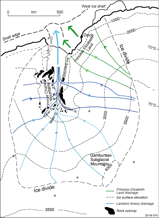
Figure F2. The Lambert Glacier drainage basin, East Antarctica, showing locations of the exposed mountains and the Gamburtsev Subglacial Mountains. Arrows show directions of ice flow today (onshore) and in prior times (offshore) when the ice sheet was greatly expanded. Ice surface elevations are in meters (modified from Hambrey et al., 1991). Gl. = Glacier. Dashed line PC offshore is the edge of the Prydz Channel.