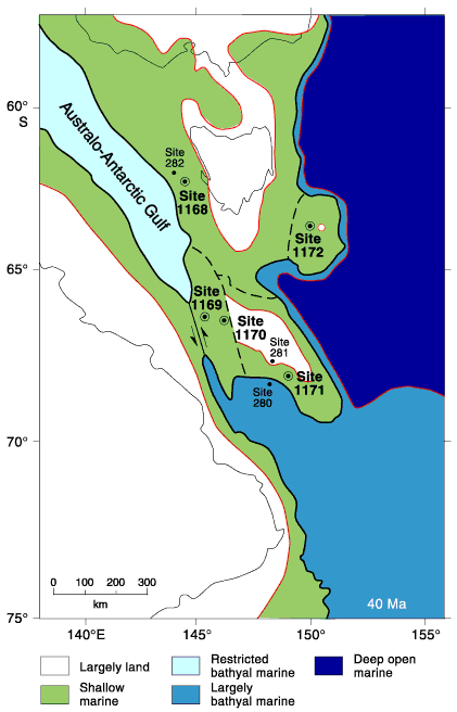
Figure F6. Paleogeographic map of Tasmanian region during the middle Eocene (40 Ma) based partly on Royer and Rollet (1997, fig. 10C) and on Leg 189 results. Solid circles = DSDP Leg 29 sites. Open circles with dots = Leg 189 sites. Late Cretaceous oceanic crust was covered with deep Pacific Ocean, and Eocene oceanic crust with bathyal ocean. Most of the Tasmania-South Tasman Rise region was covered in shallow seas. Shallow-water connections between the restricted Australo-Antarctic Gulf to the west and Pacific Ocean may have been established both north and south of the South Tasman Rise.
![]()