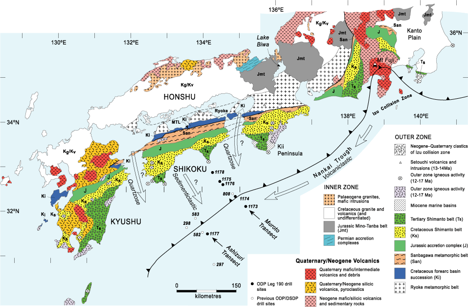
Figure F4. Simplified geological map of southwest and central Japan with the major accretionary units of the outer zone of southwest Japan depicted. The extent of Cretaceous granites and volcanics in Honshu and Kyushu includes older and younger units of lesser extent. Locations of Leg 190 and older drill sites are also shown. Inferred directions of sediment transport for the volcaniclastic (late Pleistocene), quartzose (Miocene and Pliocene-early Pleistocene), and sedimenticlastic (late Miocene) sand petrofacies are shown. Figure is compiled from the Geological Map of Japan (Geological Survey of Japan, 1992) and from figure F2 in the Leg 190 Summary of the Leg 190 Initial Reports volume (Shipboard Scientific Party, 2001a).