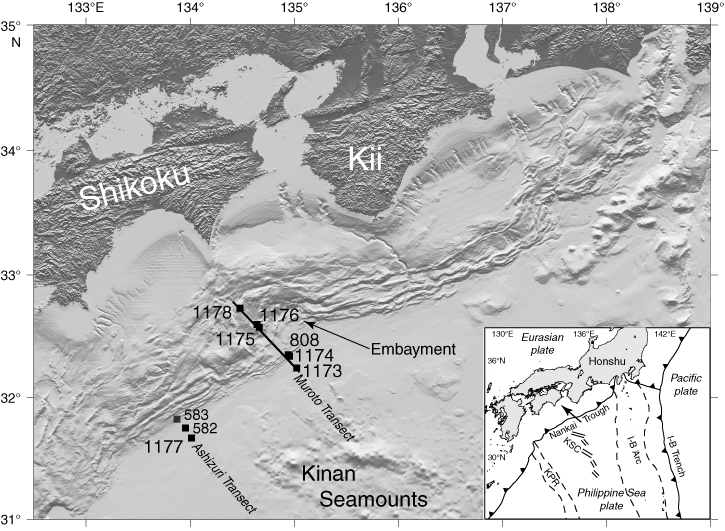
Figure F1. Shaded relief map of the Nankai Trough, produced from the Hydrographic Department of Japan's topographic data set (500-m grid interval), showing the regional setting of the Leg 190 and 196 drill sites as well as sites drilled during Leg 87 (Sites 582 and 583). Line through drill sites in Muroto Transect shows location of generalized cross section of Figure F2. The inset is a tectonic map of the Philippine Sea region that includes the Nankai Trough. I-B Trench = Izu-Bonin Trench, KPR = Kyushu-Palau Ridge, KSC = Kinan Seamount Chain (fossil spreading center).