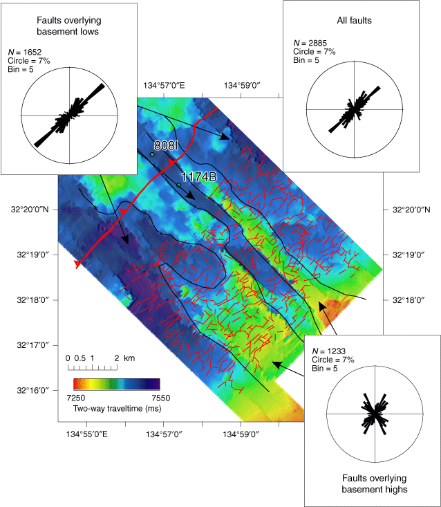
Figure F4. Two-way traveltime to subducting oceanic basement showing horst and graben structures (Heffernan et al., 2004). Colored region represents the extent of the 3-D survey. Thin red lines denote fault segments derived from a dip map on a horizon in the upper Shikoku Basin unit. All faults are normal when examined in vertical section of 3-D seismic data. Heavy red line denotes trace of the frontal thrust, with teeth on the overriding accretionary wedge. Black lines outline prominent structural trends interpreted to be relict seafloor spreading fabric. Rose diagrams of fault orientations are shown for all faults (upper right), faults overlying basement structural highs (lower right), and faults overlying basement structural lows (upper left). Faults and fractures at Site 1173 (Fig. F3) appear more random than the segments mapped seismically, perhaps due to undersampling of the former.