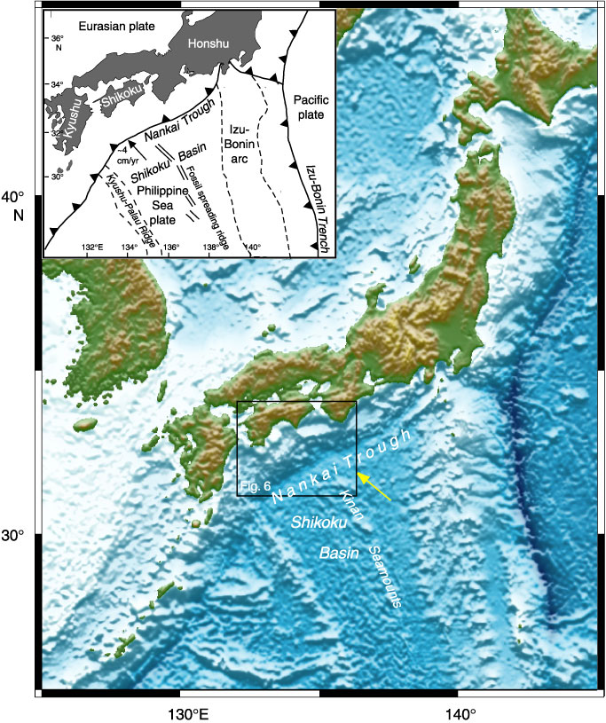
Figure F1. Shaded relief map of the Nankai Trough produced from the Hydrographic Department of Japan's topographic data set (500-m grid interval). The inset shows a tectonic map of the Philippine Sea region that includes the Nankai Trough. The black box outlines the Leg 190 Nankai drilling area shown in Figure F6. The arrow shows the convergence direction of the Shikoku Basin beneath Japan.
![]()