![]() Figures F1-F6
Figures F1-F6
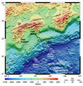
F1. Shaded relief map of the central Nankai Trough.
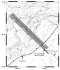
F2. Bathymetric map showing location of 1999 3-D seismic reflection grid and composite seismic line.
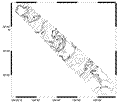
F3. Contour plot of 1999 Hydrosweep multibeam bathymetric data.
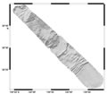
F4. Shaded relief map of Hydrosweep data.
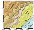
F5. Tectonic/structural domains in the Muroto Transect region.
F6. Regional seismic reflection line along the Muroto Transect.
![]()