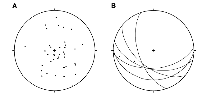
Figure F11. Equal-area lower-hemisphere stereographic projections in geographic coordinates (reoriented with Tensor tool compass data) of (A) poles to bedding and (B) fold axial planes (great circles) and fold axes (dots) measured on core-scale fold hinges. All are from the slumped intervals of Unit I (upper slope facies; 0-220 mbsf).
![]()