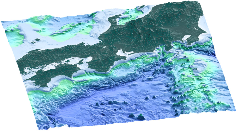
Frontispiece. Three-dimensional view of the Nankai Trough subduction zone that marks the plate boundary between the Shikoku Basin and the Japan Arc (Eurasian Plate). The Shikoku Basin oceanic crust (blue in lower center), which is part of the Philippine Sea plate and the Izu-Bonin arc (north trending high on the lower right), is subducting to the northwest beneath Japan at ~2–4 cm/yr. Active sediment accretion is taking place at the Nankai Trough. This plate boundary has historically generated earthquakes larger than M8 at intervals of ~180 yr. See Figure F6 in the "Leg 190 Summary" chapter, for detailed location of the Leg 190 Nankai Trough drilling area and drill sites. Data for the map is from Japan Maritime Safety Agency.