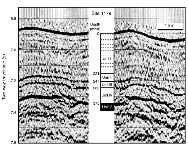
Figure F13. Comparison of the multichannel seismic reflection profile from the site survey (Hakuho Maru cruise 96-3-1), the lithostratigraphic column developed from coring at Site 1179, and depths predicted for lithostratigraphic boundaries. The lithostratigraphic column was scaled to the seismic section using the velocity-depth relationship of Carlson et al. (1986) to calculate the two-way traveltime of unit boundaries and ash layers derived from core observations. In the lithostratigraphic column, solid lines = unit boundaries; dotted lines = ash layers. Lithostratigraphic boundary depths are given in meters next to the column.
![]()