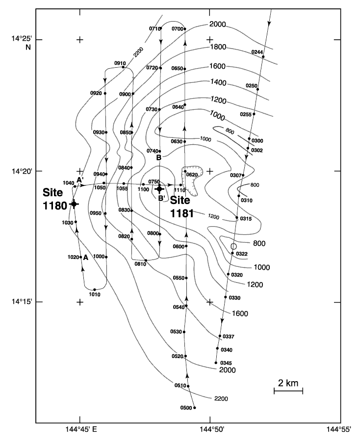
Figure F1. Bathymetry map of Inutile Seamount made by the JOIDES Resolution using the 3.5-kHz echo sounder. Contour interval is 200 m, and depths are labeled in uncorrected meters. Thin lines show ship tracks with time in UTC. Crosses show the locations of Sites 1180 and 1181. A-A´ and B-B´ indicate locations of echo sounder profiles in Figures F2 and F3.
![]()