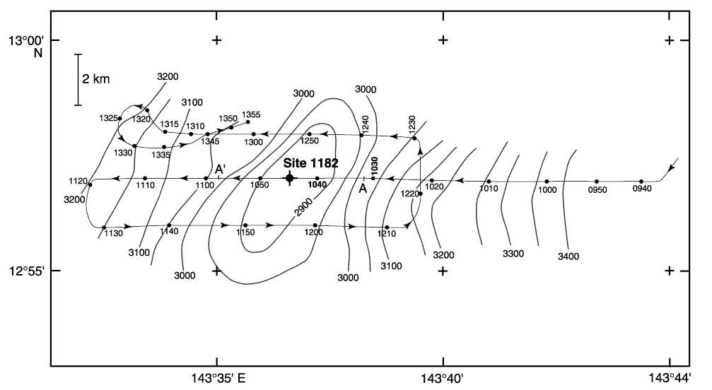
Figure F4. Bathymetry map of Martillo Seamount made by the JOIDES Resolution using the 3.5-kHz echo sounder. The contour interval is 50 m, and depths are labeled in uncorrected meters. Thin lines show ship tracks with time in UTC. The cross shows the location of Site 1182. A-A´ indicates the limits of the echo-sounder profiles in Figure F5.
![]()