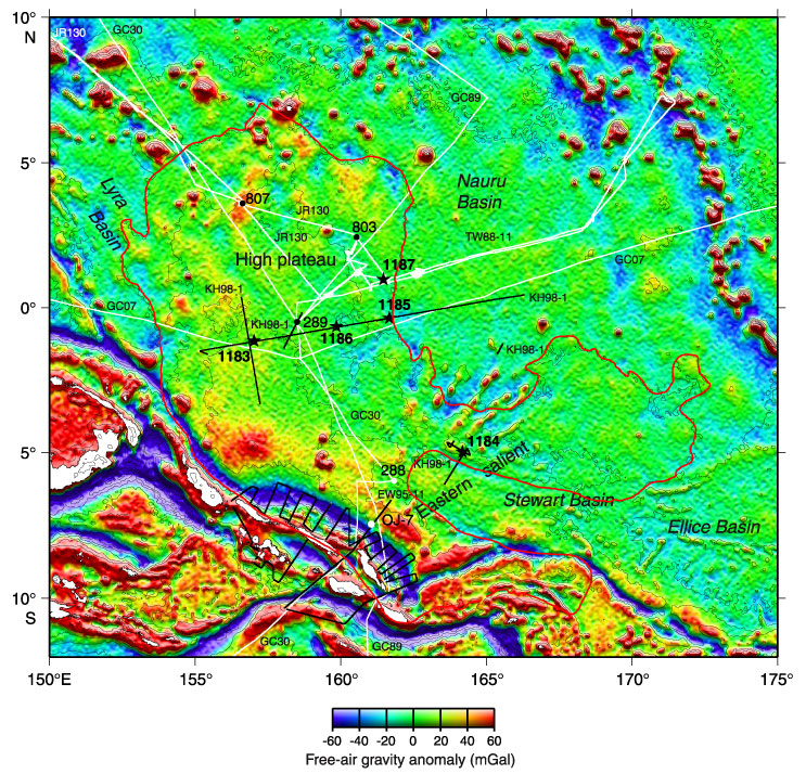
Figure F2. Satellite-derived free-air gravity map of the Ontong Java Plateau region (after Sandwell and Smith, 1997). Stars = locations of Site 1183 and other sites drilled during Leg 192. Black dots = previous ODP and DSDP drill sites that reached basement; white dots = Site 288, which did not reach basement but bottomed in Aptian limestone, and Site OJ-7, which was proposed for Leg 192 but not drilled. Black lines = surveys providing multichannel seismic control: Hakuho Maru KH98-1 Leg 2 (1998) and Maurice Ewing EW95-11 (1995). White lines = surveys providing single-channel seismic control: Glomar Challenger Leg 7 GC07 (1969), Glomar Challenger Leg 30 GC30 (1973), Glomar Challenger Leg 89 GC89 (1982), Thomas Washington TW-11 (1988), and JOIDES Resolution Leg 130 JR130 (1990). The bathymetric contour interval is 1000 m (IHO/IOC, 1997).
![]()