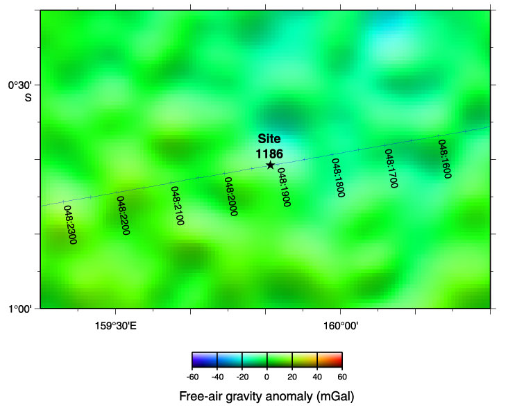
Figure F3. Location of Site 1186 and site-survey data on satellite-derived free-air gravity map (after Sandwell and Smith, 1997). Navigation for Hakuho Maru KH98-1 Leg 2 survey, Line 403, is shown in Julian-day time. Water depths in the survey area are between 2500 and 4500 m (IHO/IOC, 1997).
![]()